
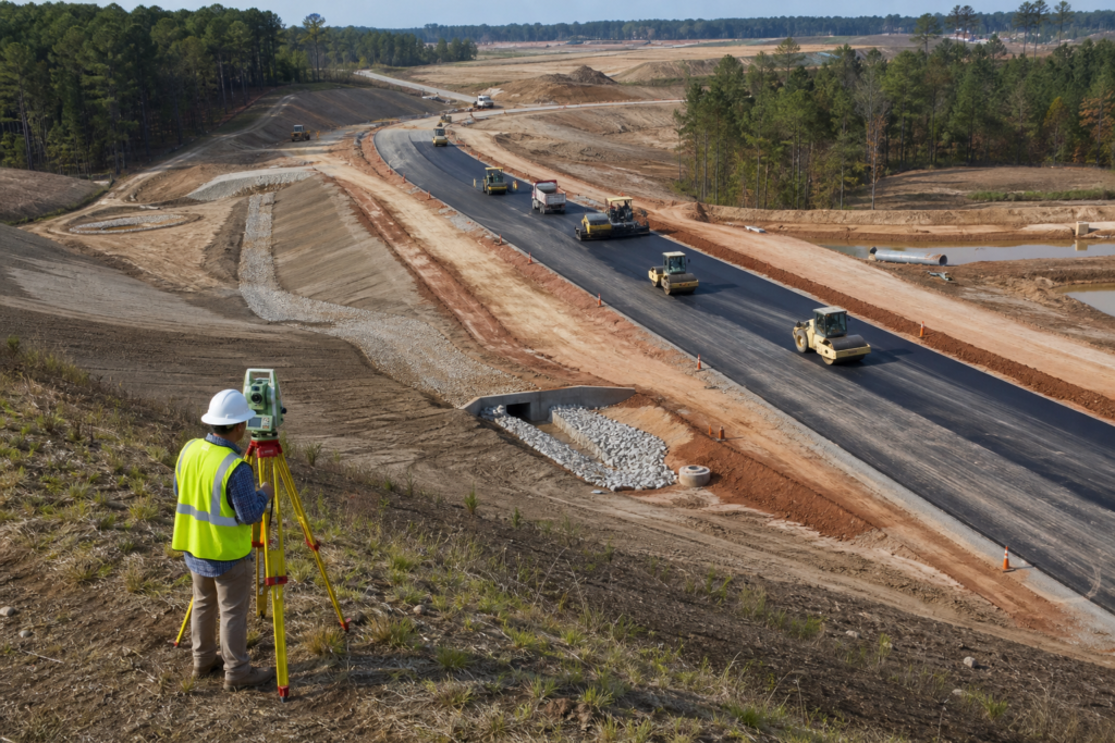
GIS mapping supports civil projects by organizing location-based information so teams can coordinate existing conditions, planned improvements, field layout, infrastructure assets, and closeout records. It can connect planning, grading, roadway construction, stormwater, erosion control, documentation, and project coordination. It does not replace surveying, engineering design, construction staking, or field verification.
The most useful approach is to treat GIS as a coordination workflow. The process begins with a defined objective, continues through data collection and field checks, and ends with organized documentation for handover or closeout.
Step 1: Define What the GIS Work Must Support
Start with the project decision or deliverable, not with a particular software platform. A development team may need to organize site features and planned improvements. A contractor may need coordination between grading, paving, drainage, and roadway work. An engineering or public-sector team may need location-based records for infrastructure documentation or closeout.
Identify whether the project needs support for site planning, construction stakeout plans, house location plans, earthwork and grading, roadway improvements, turn lanes, roadway grade calculations, stormwater systems, erosion control, estimation and takeoff, field-change records, or as-built documentation. GIS is most useful when users, outputs, and decision-makers are clear. See these civil site work best practices for Georgia project coordination.
Stop point: Confirm the project limits, intended users, required outputs, and responsible decision-makers before beginning.
Step 2: Assemble Plans, Surveys, and Existing Information

A location-based record is only as useful as its source information. Gather project boundaries, available land surveys and civil plans, existing and proposed grading information, roadway plans, access points, pavement areas, drainage or utility information, erosion-control records, previous field documentation, and required approval or closeout deliverables.
Identify which information is current, preliminary, or unverified. Do not assume that plans showing the same feature are equally reliable. GIS can organize information, but it cannot make incomplete source data accurate by itself. If the need involves physical layout, review how construction stakeout services fit into a Bethlehem, Georgia project.
Stop point: Flag missing, conflicting, outdated, or unverified information before using it to coordinate construction.
Step 3: Connect Project Features to Their Locations
GIS brings features into a location-based view. Depending on the scope, these may include property limits, structures, proposed pavement, roadway components, drainage elements, grading areas, erosion-control measures, and completed improvements. The value is coordinated information, not automatic design or construction accuracy.
Location-based organization can connect field observations, design information, construction records, and closeout documentation. GIS applications in architecture, engineering, and construction commonly support coordination across an asset’s lifecycle, as described in this overview of GIS for AEC workflows.
GIS does not automatically create an approved design, resolve a grade conflict, establish a legal boundary, or confirm that a feature was built correctly. Those conclusions require applicable plans, measurements, professional review, and field verification.
Step 4: Coordinate Grading, Roadway, and Site Work
Use organized location information to coordinate work that must fit together in the field. This is especially important where earthwork and grading affect pavement, drainage, access, structures, or erosion-control measures.
- Earthwork and grading before asphalt paving or milling.
- Roadway improvements and right, left, acceleration, or deceleration lanes.
- Stormwater systems, drainage structures, and roadway crossings.
- Erosion-control measures such as silt fence, inlet protection, check dams, seeding, mulching, and erosion matting.
- Parking areas, pavement markings, traffic signs, and wheel stops.
- Construction quantities and estimation or takeoff information.
DCBC LLC’s stated construction and consulting scope includes earthwork and grading, asphalt paving and milling, stormwater systems, erosion control, roadway improvements, construction stakeout plans, house location plans, roadway grade calculations, three-point level verification, and estimation and takeoff. These services address related field and documentation needs, while design, surveying, and approvals must remain clearly assigned for each project. Use the roadway construction compliance checklist as a coordination prompt, not a replacement for project-specific requirements.
Stop point: Confirm which information controls the work and who is responsible for setting, checking, and approving grades or construction points.
Step 5: Stop and Verify Conditions in the Field
A GIS record should be checked against current site conditions before it supports a construction decision. Sites change during clearing, grading, utility work, drainage installation, paving, and other phases. Existing records may also omit conditions that become important during construction.
Field verification may involve the responsible surveyor, engineer, contractor, or another qualified professional. Construction stakeout plans can help transfer approved information into field layout. Three-point level verification and roadway grade calculations may support specific grade or quantity questions, but a map alone does not establish construction accuracy.
Do not use GIS by itself to establish construction points, verify utilities, determine legal boundaries, set final grades, or confirm compliance.
Stop point: If mapped information and field conditions disagree, pause the affected decision and obtain appropriate review.
GIS Mapping, Surveying, Stakeout, and Design: What Is the Difference?
| Activity | Primary purpose | Useful stage | What it does not replace |
|---|---|---|---|
| GIS mapping | Organizes location-based project information. | Planning, coordination, documentation, and closeout. | Surveying, design, field verification, or staking. |
| Land surveying | Provides professional measurements and site or boundary information within the survey scope. | Existing conditions, design support, and construction control. | GIS coordination or engineering design. |
| Construction stakeout | Transfers approved project information into field layout. | Before and during construction. | Design approval or complete documentation. |
| Engineering design | Develops project-specific plans, calculations, and technical decisions. | Planning through construction. | Construction execution or GIS recordkeeping. |
| As-built documentation | Records completed or changed features for closeout and future reference. | During construction and completion. | Designing work or guaranteeing agency acceptance. |
Step 6: Record Changes During Construction
Grades, drainage features, roadway elements, pavement areas, and erosion-control measures may change as work progresses. A location-based record can help organize those changes and communicate what was observed, changed, or completed.
Decide who records field changes, who reviews them, and which information belongs in the closeout record. Transportation project delivery also benefits from organized records across project stages, as discussed in this transportation project delivery resource.
Stop point: Confirm the change-recording process before information becomes fragmented across emails, notes, drawings, and spreadsheets.
Step 7: Prepare Documentation for Closeout and Handover
At closeout, teams may need an organized record of completed site, roadway, drainage, or other infrastructure features. GIS can help assemble location-based information for handover, maintenance planning, or an as-built deliverable.
DCBC LLC offers GDOT as-built GIS submittals among its virtual and consulting services. This supports preparation of a deliverable, not a guarantee of GDOT approval. Required content and review processes depend on the project and responsible authority. Learn more about GDOT as-built GIS submittals.
Stop point: Confirm that the record reflects completed work and meets the responsible authority’s requirements before submission.
Before You Request GIS or Civil Project Support
- Define project limits and the current project stage.
- Gather available surveys, civil plans, grading, drainage, roadway, and previous field information.
- List questions about grades, quantities, pavement, stormwater, erosion control, structures, and layout.
- Identify required deliverables, such as stakeout plans, house location plans, grade calculations, three-point verification, estimation and takeoff, or GDOT as-built GIS submittals.
- Clarify field verification, surveying, design, inspection, approval, and stakeholder responsibilities.
- State whether you need construction, consulting, virtual support, or a combination.
This preparation separates a mapping need from a surveying, design, construction, or documentation need and helps a prospective partner quote the actual scope.
When Should You Involve a Contractor or Consulting Partner?
Outside support may be appropriate when the project requires coordination across grading, paving, roadway, stormwater, erosion control, quantity verification, field layout, or as-built documentation. It may also help when the team has roadway grade questions or incomplete layout information.
DCBC LLC combines civil construction with virtual and consulting services for commercial site work, residential subdivisions, roads and highways, public infrastructure, asphalt paving and milling, earthwork and grading, stormwater systems, erosion control, stakeout plans, house location plans, grade calculations, three-point level verification, GDOT as-built GIS submittals, and estimation and takeoff. Review the site work contractor selection questions and ask each provider what it will perform and what remains with the surveyor, engineer, or approving authority.
Frequently Asked Questions
Does GIS mapping replace land surveying or construction stakeout?
No. GIS organizes location-based information, while surveying and stakeout serve different professional and field purposes. GIS should complement measurements, layout, field verification, and engineering decisions.
What information should a civil project team provide first?
Provide project limits, project stage, available surveys and plans, grading and roadway information, drainage records, known changes, required deliverables, field needs, stakeholders, and agency documentation requirements.
Can GIS mapping guarantee construction accuracy or GDOT approval?
No. Accuracy, compliance, and approval depend on project documents, qualified professionals, field verification, construction practices, review procedures, and the responsible authority’s requirements.
Conclusion: Use GIS to Coordinate Information, Then Verify Every Construction Decision
GIS mapping is most valuable when it connects site conditions, planned work, field observations, infrastructure features, and closeout records. Define the objective, organize reliable information, coordinate disciplines, verify conditions, record changes, and prepare documentation that matches project requirements.
Choose support based on the actual gap: mapping coordination, stakeout plans, house location plans, grade calculations, three-point verification, estimation and takeoff, civil construction, or a combination. GIS remains one part of a broader process involving appropriate surveying, engineering, construction, review, and approval responsibilities.
DCBC LLC is a Georgia-based Georgia DOT-certified contractor offering civil construction and consulting services across Georgia. Request a quote from DCBC LLC with your project limits, available documentation, and required scope.