
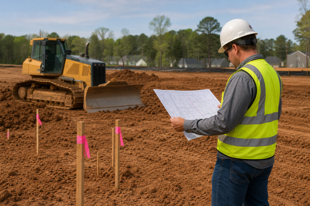
Construction stakeout plans organize the design information needed to locate, coordinate, or verify project elements in the field. For a Bethlehem, Georgia project, they may support house locations, roadway grades, grading points, paving work, and other civil site activities, depending on the approved plans and project scope.
A stakeout plan is project-specific coordination information. It is not automatically a substitute for boundary surveying, engineering design, permitting, inspection, or responsibilities assigned to qualified professionals.
What are construction stakeout plans?
In plain English, construction stakeout plans are documents or plan information used to help a project team determine where and how design elements should be represented in the field. They connect approved design information with the people performing grading, roadway construction, paving, utility, drainage, or building-related work.
The exact contents depend on the project. A plan may identify locations, reference information, elevations, grades, or other details needed for a defined scope. The requester should confirm whether the expected service is plan preparation, field layout, verification, documentation, or a combination of these activities.
Because every site has different plans, existing conditions, and responsibilities, there is no single stakeout package for every Bethlehem project. The useful question is which elements must be located or checked and what information the field team must receive.
Why stakeout planning matters on civil projects

Civil work often involves activities that must align spatially and in sequence. Grading affects drainage, drainage affects roadway and pavement areas, and roadway or building locations must correspond with the approved design. Clear layout information gives the project team a common basis for coordinating this work.
For a developer, general contractor, or public-sector project manager, the benefit is better definition of the requested work. Instead of treating field layout as an informal task, the team can identify plans, control information, project elements, revisions, and deliverables before construction advances.
Stakeout planning is one part of broader project coordination. Teams working across grading, paving, stormwater, erosion control, and documentation may also benefit from reviewing civil site work coordination practices for Georgia projects.
What project elements may require layout or verification?
A project team may discuss stakeout support for several types of elements. The appropriate scope depends on the approved design, available survey information, construction sequence, and responsibilities assigned to each consultant or contractor.
House locations
Residential subdivision work may require house location plans or related information showing where homes are intended to sit within individual lots. These plans should be coordinated with approved design information and any required survey or engineering work.
Roadway grades and paving areas
Roadway construction and paving work may require attention to proposed grades, transitions, alignment, or elevation-related information. Roadway grade calculations can be separate from a general construction stakeout plan, so the scope should state whether the need is calculation, field verification, layout, or documentation.
Grading and site features
Commercial developments and subdivisions may involve grading points, building areas, access drives, parking areas, drainage features, or other civil site components. The project team should identify which features need layout or verification rather than assuming a standard package covers the entire site.
Roadway and public infrastructure features
Roads, turn lanes, stormwater systems, erosion control measures, and related infrastructure may require coordinated field information. Public infrastructure and Georgia DOT-related work can also involve documentation and submission expectations that should be confirmed for the specific project.
How stakeout plans relate to other project deliverables
Several services can sound similar while addressing different needs. Separating them during the initial scope discussion helps prevent a project team from requesting one deliverable when it needs another.
- Construction stakeout plans
- These organize information for locating or coordinating defined project elements in the field. The scope should identify the elements, reference information, and expected use.
- House location plans
- These focus on the intended location of homes or building areas within a residential or site development context. They may be part of a broader layout discussion but are not the same as every type of stakeout plan.
- Three-point level verification from survey
- This addresses a defined level or elevation verification need based on survey information. It should not be treated as a replacement for every survey or engineering service.
- Roadway grade calculations
- These relate specifically to roadway grade information and may support roadway construction or paving coordination. The requested calculation, field activity, and documentation should be described in the scope.
- GDOT as-built GIS submittals
- These concern documentation of completed work in a GIS-related format. They serve a different purpose from planning or laying out work before construction. Teams considering this deliverable can review how GIS mapping supports civil projects.
Construction stakeout plans versus surveying and engineering
A construction stakeout conversation should clearly define professional responsibilities. Depending on the project, a licensed land surveyor, professional engineer, architect, contractor, owner, or public agency may be responsible for different parts of the design, boundary information, field layout, verification, approvals, and compliance process.
Do not assume that a construction stakeout plan establishes property boundaries, replaces a design, satisfies a permitting condition, or covers a regulatory submission. Ask the project’s surveyor, engineer, permitting authority, or contract administrator which services and approvals are required.
This distinction is especially important when a project includes public infrastructure, roadway work, drainage, or changes affecting adjacent property or public access. A contractor or consulting partner may support the project without taking on every legal, design, or regulatory responsibility.
What to confirm before requesting stakeout support
A focused scope discussion can help a contractor or consultant determine whether it can provide the requested service and what information is needed for pricing. Use these questions as a project-readiness checklist:
- What approved plans are available? Identify the current civil, architectural, roadway, grading, drainage, or subdivision plans. Note revisions and confirm which plan set controls the requested work.
- What is the project type and location? State whether the work involves a commercial development, residential subdivision, roadway, public facility, or another infrastructure project in or near Bethlehem.
- Which elements need layout or verification? List house locations, roadway grades, building areas, paving limits, drainage features, turn lanes, erosion control features, or other specific items.
- What survey or control information exists? Explain what survey information has been completed and identify the person or firm responsible for establishing or confirming relevant control.
- What deliverables are expected? Confirm whether the request concerns plans, calculations, field layout, verification, GIS documentation, files for another professional, or a combination of services.
- Who handles revisions and approvals? Establish who will review the work, communicate design changes, approve revisions, perform inspections, and coordinate with the owner or public agency.
Providing this information does not determine the legal or technical requirements for every project. It gives the service provider a clearer basis for discussing scope, coordination, and quote-based pricing.
How the scope may differ by Bethlehem project type
Commercial developments
A commercial site may combine building locations, parking areas, access drives, grading, stormwater systems, paving, striping, and signage. The stakeout discussion should identify which elements are being coordinated and how layout information will move between the design team and field crews.
Residential subdivisions
Subdivision work may involve repeated house locations, roads, lots, grading, drainage, and erosion control. House location plans may be useful for a defined portion of this work, while roadway and site elements may require separate calculations or layout information.
Roadway projects
Roadway construction can involve alignments, grades, turn lanes, acceleration or deceleration lanes, drainage, paving, and traffic-related features. The requested scope should distinguish between roadway grade calculations, field verification, construction layout, and final documentation.
Public infrastructure
Public projects may require coordination among an agency, design professionals, contractors, inspectors, and documentation teams. Confirm the project’s submission, inspection, and record requirements before treating a stakeout plan or related deliverable as complete.
When a construction-and-consulting partner may fit
A construction-and-consulting contractor may be worth considering when a project needs both civil field coordination and related office-based deliverables. DCBC LLC lists construction stakeout plans, house location plans, three-point level verification from survey, roadway grade calculations, GDOT as-built GIS submittals, and estimation and takeoff among its virtual and consulting services.
DCBC LLC also provides civil site work and roadway construction services for commercial developments, residential subdivisions, roads and highways, public infrastructure, and Georgia DOT projects. Its listed field capabilities include asphalt paving and milling, earthwork and grading, stormwater systems, erosion control, paint striping, and signage.
The fit still depends on the project’s requirements and assigned professional responsibilities. Pricing is quote-based and tailored to the requested scope, so an inquiry should include the plans, site location, project type, requested deliverables, and coordination questions described above.
Frequently asked questions
What information is usually needed to discuss construction stakeout plans?
Start with the project location, current approved plans, project type, survey or control information, and a list of elements that need layout or verification. Also identify the expected deliverable, file format if relevant, schedule dependencies, reviewers, and professionals responsible for approvals and compliance.
Are construction stakeout plans the same as a land survey?
No. A stakeout plan supports the layout or coordination of defined construction elements, while a land survey can address different purposes such as boundaries, existing conditions, or other survey needs. Confirm the required surveying and engineering services with the appropriate qualified professionals.
When should a project team address stakeout planning?
Discuss it while the scope, plans, sequencing, and responsibilities are being coordinated, rather than waiting until a field crew needs information immediately. Early discussion helps identify missing plans, survey information, layout elements, revision procedures, and documentation expectations.
Can construction stakeout plans support roadway and subdivision projects?
They may support both, but the required content will differ. A subdivision may emphasize house locations, lots, grading, and internal roads, while roadway work may involve grades, alignments, turn lanes, drainage, paving, and related documentation.
Choosing the right next step for your project
Construction stakeout plans are project-specific information for translating approved design intent into coordinated field work. For a Bethlehem project, the right scope may involve house location plans, roadway grade calculations, level verification, broader civil site coordination, or related documentation.
Before commissioning the work, identify the elements that need layout, gather the latest plans and survey information, and confirm which responsibilities belong to the contractor, surveyor, engineer, owner, or public agency. This will help determine whether you need a focused stakeout deliverable or a broader construction-and-consulting scope.
DCBC LLC is a Georgia-based civil site work and roadway construction contractor based at 255 Gateway Dr #300, Bethlehem, GA 30620. Contact DCBC LLC for a project quote covering construction stakeout plans or related civil site and consulting services.