
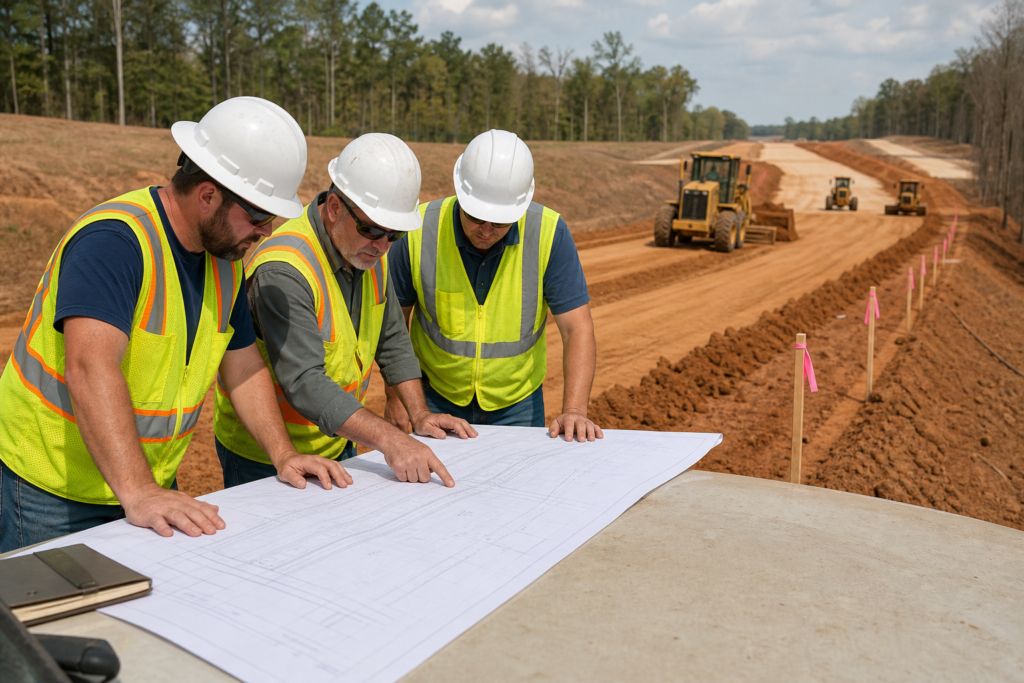
Roadway grade calculation methods help project teams relate elevation changes to horizontal distances along a proposed or existing roadway. A reliable process connects the project objective, approved plans, survey control, tie-in conditions, field verification, and required review.
The right approach depends on what the calculation must establish. An office review of plan elevations differs from construction stakeout plans or field-level verification. Each can support roadway construction, but none automatically proves compliance, constructability, drainage performance, or safety.
The roadway grade calculation workflow
Use this sequence to move from a project question to a documented, reviewable result. The stop points help prevent a calculation from moving into earthwork, paving, drainage, or roadway construction before its inputs are checked.
- Define the calculation objective.
- Review plans, datum, and survey control.
- Collect or validate elevations and distances.
- Perform and review the calculation.
- Compare the result with project requirements.
- Verify the grade in the field.
- Document the calculation and verification.
Step 1: Define what the grade calculation must establish

Start by identifying the decision the calculation must support. It may concern a proposed roadway profile, an existing-to-proposed tie-in, earthwork and grading, paving preparation, a turn lane, an acceleration or deceleration lane, or drainage coordination.
The required output changes with the objective. A team may need a plan-based calculation, marked field points, an existing-to-proposed comparison, or a package for construction coordination. Clarify whether the result is for design review, estimating, layout, quality control, or closeout.
Stop point: confirm the responsible reviewer
Identify who will accept the result. Depending on the project, that may be the design professional, surveyor, engineer, contractor, owner, municipality, or agency reviewer. Confirm the expected format and whether sealed surveying or engineering documents are required.
Step 2: Review plans, reference datum, and survey control
Review the relevant plan sheets, roadway alignment, stationing, profile information, benchmarks, reference datum, proposed and existing elevations, and connection points. Identify the beginning and ending points being compared.
A calculation can be misleading if points are not on the same alignment, elevations use different datums, or an existing tie-in has changed since the survey or plan was prepared. For public infrastructure work, document the source of each requirement and the responsible reviewer. A roadway construction compliance checklist can organize review questions but does not replace project-specific requirements.
Stop point: resolve conflicting or incomplete control
Pause if the benchmark, datum, alignment, stationing, existing elevation, or proposed information is missing or inconsistent. Do not silently choose between conflicting values. Record the issue and obtain clarification before proceeding.
Step 3: Collect or validate the elevations and distances
A meaningful calculation requires clearly identified elevations and a horizontal distance between the points being compared. Label whether each value is existing, proposed, surveyed, field-observed, or taken from a plan. Keep units consistent and identify every point, station, or feature.
Compare plan information with current site conditions where the result will guide construction. Earthwork, prior work, settlement, excavation, paving, or changes near a tie-in can make field conditions differ from the documents.
The data-collection method should match the project control and deliverable. A convenient measurement is not automatically suitable for design acceptance or construction layout.
Step 4: Perform the roadway grade calculation
At a conceptual level, roadway grade relates the elevation change between two defined points to the horizontal distance between them. Show the starting point, ending point, direction, units, elevation source, and assumptions.
Keep the calculation separate from the conclusion. First show the inputs and result, then explain what the result means for the project question. A calculated grade describes a relationship between points, but it does not establish that the design meets every applicable requirement.
Retain the source plan or survey reference, point descriptions, elevations, distance, units, relevant field date, and assumptions. If the calculation changes, record why and identify the current version.
Stop point: check the result before using it for construction
Check arithmetic, units, direction, elevation order, station references, and start and end points. Compare the result with the plan profile and investigate unexpected differences. A reasonable-looking result is not enough if the points or datum are wrong.
Step 5: Compare the result with project requirements
Review the calculated grade against approved plans and project conditions, including roadway geometry, tie-ins, drainage coordination, adjacent grades, earthwork, paving limits, and applicable owner or agency requirements.
This is a coordination review, not design approval. Do not apply a generic slope limit, drainage assumption, or accessibility conclusion without confirming the applicable documents and standards. If the result conflicts with the approved design, refer it to the responsible reviewer.
Step 6: Verify the grade in the field
An office calculation explains the relationship between documented points. Field verification checks whether the relevant points, elevations, and layout information can be identified and coordinated at the site.
Construction stakeout plans serve a different purpose from a plan-only calculation. They help transfer approved design information to physical locations. A comparison of construction stakeout services can help teams distinguish layout support from calculation and verification.
Three-point level verification may be appropriate for a defined scope when control, points, and the reviewer are clear. It is not a universal replacement for surveying, engineering, or required layout procedures.
How the main roadway grade calculation methods differ
| Approach | Purpose | Useful stage | Limitation |
|---|---|---|---|
| Office plan calculation | Relates documented elevations and distances to answer a defined question. | Review, estimating, coordination, and construction preparation. | Depends on complete and consistent plans and control. |
| Construction stakeout plans | Organize approved design information for field layout. | Construction layout and coordination. | Do not resolve unclear design intent or replace professional review. |
| Three-point level verification | Checks a defined relationship among selected field points. | Field coordination when points and acceptance are defined. | Limited to selected points, not automatically the entire roadway. |
Step 7: Document the calculation and verification
Assemble source plans, survey-control references, point descriptions, elevations, distances, units, assumptions, calculations, field observations, verification notes, reviewer comments, revisions, and final deliverables.
Note differences between planned and observed conditions rather than hiding them in a revised number. If the work affects paving, earthwork, stormwater, erosion control, or roadway tie-ins, identify the coordination item and responsible party.
Coordinate grade work with paving, earthwork, and stormwater
Roadway grade decisions affect related scopes. Earthwork depends on existing and proposed elevations, while asphalt paving and milling depend on the prepared surface and grades. Turn lanes and acceleration or deceleration lanes add tie-in and alignment coordination.
Stormwater systems also interact with roadway grades. Pipe runs, inlets, catch basins, manholes, slopes, and outlets may affect surrounding work. Erosion control should be coordinated with construction sequencing and site conditions.
When to stop self-checking and involve qualified professionals
Stop and request qualified review when survey control is missing, elevations conflict, a tie-in is unclear, the design changes, drainage concerns arise, or field conditions do not match approved documents. The same applies when an owner, agency, or contract requires certification, sealed documents, or formal approval.
Additional review is appropriate when the result will resolve a dispute, support a significant design change, determine whether work can proceed, or affect safety-critical roadway conditions. A basic calculation can inform discussion but should not be used beyond its stated scope.
What to prepare before requesting roadway grade support
- Project location, type, and construction phase.
- Approved plans, profiles, alignments, revisions, and specifications.
- Survey files, benchmarks, datum, control points, and stationing.
- Existing and proposed elevations, dates, and comparison points.
- Tie-ins, turn lanes, access points, drainage features, paving limits, and earthwork areas.
- Requested deliverable, such as a calculation, verification, stakeout plan, or documentation package.
- Responsible reviewer, required format, agency involvement, and sealed-document requirements.
- Related paving, milling, stormwater, erosion-control, or takeoff needs.
How DCBC LLC can support Georgia roadway projects
DCBC LLC is a Georgia DOT certified contractor providing civil site work and roadway construction support across Georgia. Its listed virtual and consulting services include roadway grade calculations, three-point level verification, construction stakeout plans, house location plans, GDOT as-built GIS submittals, and estimation and takeoff.
Its field capabilities include earthwork and grading, asphalt paving and milling, stormwater systems, erosion control, paint striping and signage, turn lanes, and acceleration or deceleration lanes. Support remains subject to project documents, review responsibilities, and required professional qualifications.
Roadway grade calculation methods FAQ
What information is needed before calculating roadway grade?
You need the points being compared, elevations, horizontal distance, datum, alignment or station references, and the source of each value. You should also know whether points are existing or proposed and what decision the result must support.
What is the difference between a roadway grade calculation and construction stakeout?
A calculation evaluates the relationship between defined elevations and distance. Stakeout transfers approved design information to physical locations. Stakeout may use grade information, but it does not resolve unclear design intent or replace required professional review.
When should roadway grade results be verified in the field?
Verify results before construction relies on them when site conditions, tie-ins, control, or existing elevations may differ from the documents. The reviewer should define the points, method, and acceptance process.
Can a roadway grade calculation replace surveying or engineering review?
No. It can support coordination and identify questions, but it does not replace surveying, engineering design, sealed documents, agency review, or project-specific acceptance requirements.
Choose the calculation method that matches the deliverable
Begin with the project question, then confirm plans, datum, survey control, elevations, distances, and the responsible reviewer. Calculate transparently, compare the result with approved requirements, verify relevant points in the field, and document the outcome. If control or design intent is unclear, stop before construction relies on the result.
Georgia developers, contractors, engineering teams, municipalities, and public agencies can request a quote from DCBC LLC for roadway grade calculations, three-point level verification, construction stakeout plans, or related civil site work.