
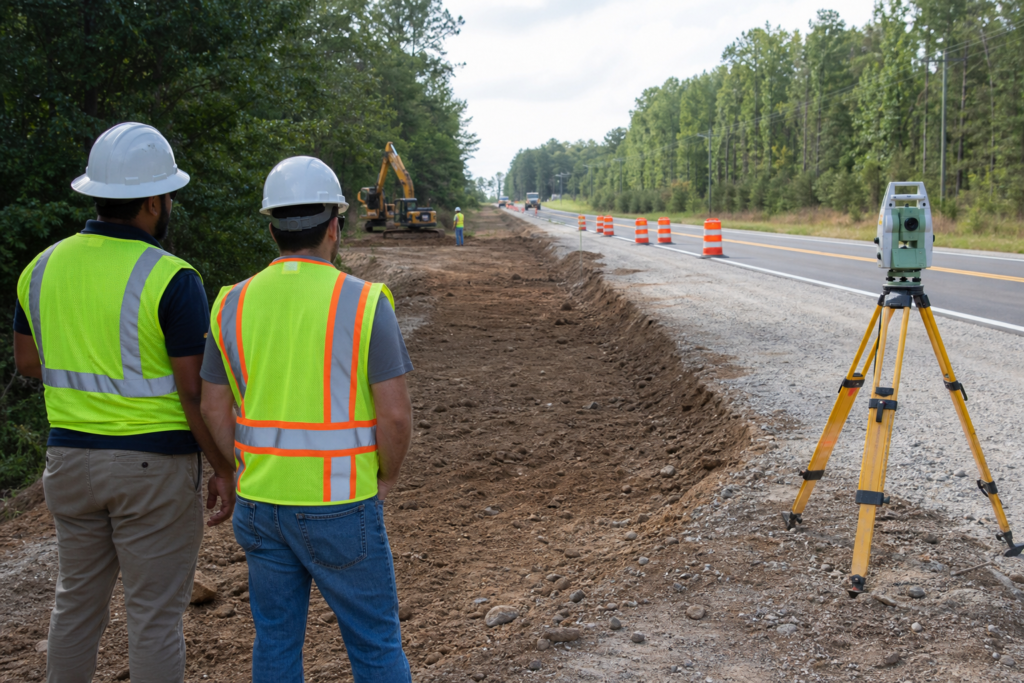
Right-of-way permitting authorizes specific work, access, occupation, or construction within or affecting a publicly controlled roadway area. In Georgia, the correct path depends on who controls the right-of-way and what you plan to do, such as a driveway connection, utility installation, drainage work, excavation, sidewalk work, lane closure, or temporary obstruction. For GDOT-controlled work, GPAS supports access, signal, speed-zone, and utility permit functions, but it is not a universal permit system for every project.
What Right-of-Way Permitting Covers
A right-of-way approval authorizes defined work in a public transportation corridor. That corridor may include travel lanes, shoulders, sidewalks, drainage features, utility areas, access points, easements, or other land controlled by a public agency. The exact boundary is not determined by the project address alone.
Georgia does not use one universal right-of-way permit for every civil project. A driveway connection may follow an access or encroachment path, while utility work may require a utility permit. Lane closures, sidewalk obstructions, drainage connections, and roadway improvements can introduce additional agency reviews or traffic-control documentation.
Right-of-way approval is different from private-site permitting. A project may separately need land-disturbance approval, building permits, stormwater authorization, utility-owner approval, environmental review, traffic-control approval, or other local permits.
GDOT describes an encroachment permit as authorization for specific work on a state right-of-way and identifies permit-inspector involvement while permitted work is under construction. GDOT’s driveway and encroachment manual explains that responsibility boundary.
First Decision: Who Controls the Right-of-Way?

The controlling authority is usually the agency that owns or manages the roadway or public corridor where the work will occur. Start with the roadway, shoulder, sidewalk, drainage feature, or easement affected by the work. Verify the responsible agency before relying on a form, fee schedule, insurance requirement, bond amount, or review timeline.
| Possible authority | Common triggers | Verify first |
|---|---|---|
| City | Driveway access, sidewalk work, utility cuts, temporary obstructions, drainage connections, or roadway work on city streets | Street ownership, right-of-way limits, application portal, restoration standards, and traffic-control process |
| County | Work affecting a county road, shoulder, drainage feature, access point, or county-maintained corridor | County control, permit category, plans, inspections, and restoration responsibility |
| Georgia DOT | Access, utility, signal, speed-zone, driveway, lane-interruption, or other work involving GDOT-controlled right-of-way | Permit category, current portal or form, traffic-interruption requirements, plans, and construction conditions |
| Utility owner or another authority | Connection, relocation, protection, or work near an existing utility | Facility ownership, locate requirements, conflict resolution, and separate approvals |
GPAS is Georgia DOT’s online system for processing, tracking, and maintaining signal, access, speed-zone, and utility permits. It is not the required portal for every local street, private development, or Georgia civil project. Review the current GPAS categories alongside the verified right-of-way jurisdiction.
GDOT states that utility owners must submit permits for work requested within GDOT-owned right-of-way through the applicable Georgia utility permitting system. The agency’s utility permitting FAQs clarify GDOT’s role, but the project team still needs to identify the specific corridor and work category.
Match the Work to the Approval Path
Ask two questions before preparing an application: Will the work occupy, excavate, cross, connect to, or obstruct publicly controlled space? Which agency controls that space? If either answer is uncertain, verify it before mobilization.
- Driveway or access connection: A new or modified access point may require access or encroachment approval involving sight conditions, drainage, pavement, traffic movements, and restoration.
- Turn lanes and roadway improvements: Turn lanes, acceleration or deceleration lanes, widening, shoulder changes, and roadway tie-ins can affect public pavement, traffic operations, drainage, and staging.
- Utility installation or relocation: Water, sewer, stormwater, gas, electric, telecommunications, and other utility work may require utility-owner coordination plus an agency permit.
- Drainage work: Pipes, inlets, ditches, culverts, and outfalls can affect roadway drainage, downstream conditions, erosion control, and adjacent property.
- Excavation: Trenching, boring, open-cut work, pavement removal, and excavation near a roadway may require approval. Include work limits, depth, restoration, utilities, and traffic protection.
- Sidewalk or pedestrian work: New sidewalks, curb ramps, driveway crossings, and pedestrian-route closures may require right-of-way review and temporary pedestrian controls.
- Lane closures and temporary obstructions: Equipment, dumpsters, materials, staging areas, traffic shifts, and temporary access restrictions may require separate documentation.
- Restoration: Pavement, shoulders, curbs, sidewalks, drainage structures, striping, signs, and landscaping may have different restoration requirements.
Identify permit lead times, right-of-way requirements, utility approvals, and agency review steps before publishing the schedule. A permit lead times and right-of-way requirements checklist helps organize those decisions.
A single commercial entrance may involve access approval, utility coordination, stormwater review, traffic-control documentation, land-disturbance requirements, and pavement restoration. Treat the permit path as a coordinated package, not one form submitted in isolation.
Build a Complete Pre-Application Package
A complete package gives the reviewing agency enough information to understand what will be built, where it will occur, how traffic and utilities will be protected, and how the corridor will be restored. Exact requirements vary by agency, work type, and conditions.
Core project information
- Current plan set with revision dates and consistent project limits.
- Property boundaries, public right-of-way limits, easements, access points, and staging areas.
- Project address, roadway name, route information where applicable, and location map.
- Written description of the work, construction method, sequence, and anticipated disturbance.
- Existing and proposed grades, drainage paths, pavement edges, sidewalks, structures, and tie-ins.
- Survey control, benchmarks, topographic information, and field conditions used for the plans.
Utilities, traffic, and restoration
- Utility records, locate requests, utility-owner contacts, and known conflicts.
- Utility protection, relocation, crossing, or abandonment details.
- Traffic-control or maintenance-of-traffic drawings for closures, pedestrian detours, shoulder work, or access changes.
- Work-hour assumptions, equipment locations, delivery routes, and emergency-access provisions.
- Restoration details for asphalt, concrete, curb and gutter, sidewalks, striping, signs, drainage features, and disturbed shoulders.
- Inspection points, testing records, as-built information, photographs, and closeout deliverables.
Agency and contractor documents
- Current application, plan format, file-naming rules, and submission instructions.
- Insurance certificates, bonds, licenses, registrations, or hold-harmless documents if required.
- Application fees, deposits, inspection fees, or final permit charges where applicable.
- Owner authorization, easement evidence, utility-owner approvals, or other permissions.
- Contacts for the owner, designer, contractor, traffic-control lead, utility coordinator, and agency representative.
Insurance, bonds, licenses, fees, plan scales, file formats, and drawing requirements are jurisdiction-dependent. Do not transfer a requirement from another agency or state without verifying that it applies.
Early utility coordination can include records research, utility-owner contacts, meetings, conflict tracking, permit coordination, field-verification planning, construction updates, and closeout documentation. It does not replace surveying, engineering design, locating, inspections, or utility-owner decisions.
For GDOT projects, review the current GDOT design-related resources. A design checklist is not itself a permit approval.
The Application Workflow: Submission Through Issuance

- Confirm jurisdiction. Identify the controlling agency, permit category, contact, portal, or form.
- Define the complete scope. Include temporary work, utility crossings, traffic shifts, excavation, drainage, restoration, and closeout.
- Prepare coordinated documents. Check that plans, revision dates, traffic-control materials, utility information, quantities, and restoration details agree.
- Submit through the required channel. Follow file, signature, upload, payment, and deposit instructions and retain the submission record.
- Track review comments. Assign each comment to the owner, designer, contractor, utility owner, or other responsible party.
- Revise and resubmit. Use a new revision identifier, address every comment, and maintain a response log.
- Complete approval and payment steps. Final fees, deposits, bonds, insurance, or other conditions may apply before issuance.
- Distribute the issued permit. Give approved documents and conditions to the superintendent, traffic-control team, utility coordinator, inspectors, and subcontractors.
- Close out the work. Complete restoration, inspections, punch-list items, photographs, as-built records, and agency deliverables.
There is no universal Georgia review timeline. Duration depends on the agency, permit category, package completeness, revisions, utility conflicts, traffic effects, and related approvals.
How Approval Changes Construction Sequencing

Right-of-way status affects mobilization, traffic controls, excavation, utility exposure or relocation, inspections, and field documentation. For a driveway or turn lane, coordinate survey control, grading, drainage, subgrade, asphalt transitions, striping, signs, and restoration. For utility or stormwater work, coordinate locating, field verification, trenching, pipe installation, structures, backfill, erosion control, pavement repair, and records.
Permitting coordination should connect with grading, drainage, utilities, erosion control, inspections, sequencing, and closeout before mobilization.
Do not place crews, excavations, equipment, materials, or traffic control in the affected public area until required authorization and field conditions are confirmed. Work outside approved limits can conflict with traffic, utilities, pedestrians, inspectors, or agency conditions.
Four Application Problems That Create Rework
1. Assumed right-of-way limits
Hypothetical problem: A driveway and drainage plan omits the public boundary and controlling agency.
Correction: Verify roadway control, easements, shoulder limits, sidewalks, drainage features, and access ownership before finalizing plans.
2. Outdated plan revision
Hypothetical problem: The application uses an older grading plan after the driveway, outlet, or utility route changed.
Correction: Reconcile civil, roadway, drainage, utility, traffic-control, and restoration drawings under one revision date.
3. Missing traffic or pedestrian details
Hypothetical problem: A shoulder trench is shown without explaining vehicle, pedestrian, driveway, or emergency access.
Correction: Add the agency-required traffic-control or pedestrian-control information, staging, access changes, and restoration sequence.
4. Unresolved utility conflicts
Hypothetical problem: A storm line crosses a facility shown only on an old record drawing.
Correction: Identify the owner, obtain records and field verification, track the conflict, and assign protection or relocation decisions to the responsible party.
Choose an In-House, Contractor-Led, or Hybrid Approach
In-house management can fit a project with a clear jurisdiction, familiar permit category, complete design documents, limited utility conflicts, and an experienced team. Assign responsibility for submission, agency communication, revisions, traffic control, inspections, restoration, and closeout.
Contractor-led coordination can be practical when the work combines roadway access, grading, drainage, utilities, paving, traffic control, and restoration. A hybrid model can pair professional design and approvals with contractor support for quantities, field constraints, sequencing, layout, utility coordination, construction, or closeout records.
A contractor-led or hybrid approach still leaves technical approvals and agency decisions with the responsible engineer, surveyor, utility owner, owner, contractor, or reviewing agency, according to the part of the work each party controls.
Questions to Verify Before You Submit
- Who controls the affected roadway, shoulder, sidewalk, drainage feature, or easement?
- Which category applies: access, encroachment, utility, traffic interruption, excavation, temporary use, or another process?
- Are the current form, portal, plan guide, and file format being used?
- Do plan limits, revision dates, scope, traffic-control details, and restoration notes agree?
- Which utility owners must be contacted, and who resolves conflicts?
- Are insurance, bonds, licenses, authorizations, fees, or deposits required?
- What inspections, notifications, restoration standards, and closeout records apply?
- Who answers agency comments and approves design changes?
- What happens if field conditions, utilities, grades, access, or limits change after issuance?
Verify current requirements directly with the controlling authority before submitting or scheduling work. A permitting checklist example can illustrate organization, but its local requirements do not transfer to Georgia. Related reading: What Should You Check Before Southern California Permitting?.
Right-of-Way Permitting FAQ
What is a right-of-way permit?
It is authorization for defined work, access, occupation, excavation, or construction within or affecting a publicly controlled transportation corridor. It does not automatically authorize unrelated private-site, utility-owner, land-disturbance, building, or stormwater work.
How do I know whether GDOT or a local agency controls the right-of-way?
Identify the owner or controlling agency for the exact work location, including the shoulder, sidewalk, drainage feature, and access point. Confirm it before choosing a portal because the project address alone does not establish jurisdiction.
Does a driveway connection need separate approval?
A new or modified driveway may need access or encroachment approval when it connects to a public roadway. The category depends on the controlling agency and proposed work.
Is GPAS required for every Georgia right-of-way project?
No. GPAS supports GDOT categories including access, signal, speed-zone, and utility permits. Local streets and other project types may follow a different process.
Do right-of-way permits replace other permits?
No. Separate land-disturbance, stormwater, building, utility-owner, traffic-control, environmental, or other approvals may still apply.
Who should prepare revisions?
The owner or general contractor should assign one team to manage submissions, comments, revisions, and approved-document distribution. Contractors can support field scope and coordination while responsible technical parties retain their decisions.
What if plans change after issuance?
Determine whether the change affects approved limits, traffic control, drainage, utilities, access, restoration, or safety. Document it and ask the controlling agency whether a revision, supplemental approval, or new application is required.
For Georgia projects that need a construction and consulting company, review DCBC LLC’s civil site work services and prepare the site plans, known right-of-way limits, utility information, proposed work, and required deliverables before requesting project details.