
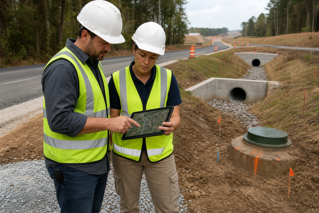
GDOT as-built GIS workflows are best understood as a coordinated project process, not the name of one official Georgia Department of Transportation program. The work connects contract review, field verification, GPS and GIS data collection, attribute and metadata preparation, quality control, submission, comment resolution, and final closeout.
Exact asset lists, accuracy requirements, file formats, software, attributes, and submission routes depend on the contract and applicable GDOT requirements. Defining those details before construction helps prevent the need to reconstruct locations and records after installation.
What a GDOT As-Built GIS Workflow Includes
An as-built GIS workflow turns verified information about constructed assets into organized location data and supporting records for review, handoff, maintenance, or future project use. It may cover roadway, drainage, utility, stormwater, or other infrastructure features identified by the project documents.
These related terms are not interchangeable:
- As-built data: Information describing what was actually installed, including final locations and relevant attributes.
- GPS data: Field-collected positional information used to locate specified assets. The required method and accuracy come from the applicable documents.
- GIS data: Organized spatial features with geometry, attributes, coordinate information, and supporting documentation.
- Survey deliverables: Professional survey information and files required by the contract. GIS data does not automatically replace survey work.
- Record drawings: Drawings or marked-up plans showing constructed conditions. They may support GIS records but are not necessarily the same deliverable.
- OpenRoads files: Design or survey-related files used on applicable GDOT projects. OpenRoads Designer is not automatically sufficient for every GIS submittal.
Georgia DOT identifies an OpenRoads Designer workspace for initial surveys on applicable projects and consultant-designed projects where ORD survey deliverables are received. Review the current OpenRoads guidance when the contract calls for it.
The Workflow From Planning to Closeout

1. Review contract and deliverable requirements
Begin with the contract, plans, specifications, special provisions, applicable GDOT manuals, and asset or GIS standards identified by the owner. Create a requirements register covering assets, accuracy, attributes, metadata, coordinate system, file formats, supporting records, reviewer, submission system, and acceptance criteria.
Do not apply requirements from one project automatically to another. GDOT maintains roadway design manuals and software resources through its R.O.A.D.S. materials, but the controlling project documents determine the deliverables for a particular job. Check the applicable GDOT design resources alongside the contract.
2. Establish field control and capture changes
Before installation, confirm benchmarks, control information, planned asset locations, site access, and the handoff between construction, inspection, survey, and GIS personnel. Decide when each asset will be recorded and how field changes will connect to plans, photographs, inspection notes, and approved changes.
Capturing information while an asset is exposed or being installed is generally more reliable than inferring its location after backfill, paving, or restoration. Confirm which activities require a licensed surveyor and which records must be prepared by a qualified specialist.
3. Collect GPS and GIS data
Collection should follow the project asset inventory and data dictionary. A drainage-focused scope may identify conveyance structures, pipes, inlets, outlets, and related features, while another project may require roadway or utility assets.
Georgia DOT Special Provision 156 addresses collecting locations and attributes for specified stormwater and drainage assets, processing and submitting GIS data according to department policies, and maintaining quality assurance and quality control. Read the supplied Special Provision 156 reference for the applicable scope.
Field crews should record required geometry and attributes consistently. Potential fields may include asset type, identifying information, elevations, connections, photographs, and installation details, but the project documents control the actual requirements.
4. Process attributes and metadata
Processing converts field observations and supporting records into a structured deliverable. It may involve checking coordinate information, organizing points, lines, or polygons, applying the required schema, documenting collection methods, preparing metadata, and packaging files for review.
Metadata should explain what the data represents, when and how it was collected, which coordinate reference applies, what limitations exist, who prepared it, and which source records support it. GIS processing does not replace engineering design or survey certification.
GDOT policy states that GPS and GIS personnel may be evaluated on training, equipment use, collection practices, data processing, metadata preparation, and software. It also places responsibility for deliverable quality with the prime contractor or consultant. Review GDOT policy 8085-2 when assigning technical responsibility.
5. Perform quality assurance and quality control
Check completeness, positional accuracy, attributes, metadata, file integrity, and consistency with plans, inspection records, field notes, and approved changes. Use a documented process with a preparer, checker, and responsible approver where appropriate.
Record exceptions, missing information, corrected features, and unresolved questions so the final package does not conceal uncertainty. A practical GDOT as-built GIS submittal checklist can connect field verification, testing, responsibility assignments, record drawings, and closeout documentation.
6. Submit, resolve comments, and close out
Package GIS files, metadata, supporting records, drawings, photographs, testing information, and required forms according to the contract. Identify who receives the package, tracks comments, makes corrections, and confirms that revised files replace earlier versions.
For applicable post-letting MS4 work, GDOT materials reference Special Provision 156 and final acceptance materials that can include a completed CEI checklist, final BMP list, final plan sheets, as-built data, and GPS data. This is an example, not a universal closeout package. Review the GDOT MS4 process reference when it applies.
7. Separate review from acceptance
A contractor or consultant can prepare and check a deliverable, but the owner, engineer, inspector, or GDOT reviewer may have separate authority to request corrections and determine whether contract requirements have been met.
8. Retain the final record set
Keep submitted or accepted files, revision history, field records, photographs, metadata, comment responses, and correspondence in the project record system required by the contract. Future maintenance decisions may depend on knowing both what was installed and how it was verified.
Who Owns Each Part?
| Activity | Typical lead | Confirm |
|---|---|---|
| Define deliverables | Owner, agency, or engineer | Asset list, provisions, reviewer, and submission route |
| Report field changes | Prime contractor and crews | Collection timing, photographs, and inspection records |
| Collect positional data | Survey, GPS, or qualified field team | Method, accuracy, control, and professional responsibilities |
| Prepare GIS and metadata | GIS specialist or consultant | Schema, coordinate system, formats, and source records |
| Check the package | Contractor, consultant, or designated checker | QA/QC procedure and correction tracking |
| Review and accept | Owner, GDOT, engineer, or inspector | Comment process and final acceptance authority |
Interfaces create much of the risk. A GIS specialist may not know an asset moved unless construction reports it, while construction staff may not know the required attribute schema unless the owner provides it. Assign every handoff before mobilization.
Pre-Mobilization Checklist
- Identify controlling documents, revisions, special provisions, manuals, and data standards.
- List asset types, geometry, attributes, accuracy, metadata, and supporting records.
- Confirm coordinate reference system, survey control, equipment, software, and file formats.
- Define when each asset will be collected before it becomes inaccessible.
- Assign field collection, GIS processing, metadata, QA/QC, corrections, submission, and retention.
- Confirm whether OpenRoads, GeoPI, ProjectWise, or another system is required.
- Establish review hold points for drainage, utility, and roadway assets.
- Connect photographs, inspection notes, tests, and record drawings to GIS features.
- Confirm the reviewer, correction cycle, naming conventions, and acceptance process.
GDOT’s GeoPI platform provides tools for searching, viewing, downloading GIS data, measuring, and working with map layers. It does not by itself establish the submission method for a specific project. View the GDOT GeoPI tools for context.
In-House, Contractor-Led, or Hybrid Support?
| Model | Best fit | Main tradeoff |
|---|---|---|
| In-house | Teams with experienced field, survey, GIS, and document-control staff | Internal staff carry the equipment, coordination, QA/QC, and correction burden |
| Contractor-led | Projects where the construction team controls access and captures changes during installation | The contract must clearly assign qualifications, data ownership, and deliverable responsibility |
| Hybrid | Teams needing contractor field information plus specialized GIS processing or virtual documentation | Handoffs must be explicit so information is not lost |
In-house delivery may suit a simple scope when the team has the required expertise and equipment. Complex roadway, drainage, or utility work may justify contractor-led or hybrid support because construction sequencing, field access, documentation, and GIS processing must work together.
Where DCBC LLC May Fit
DCBC LLC identifies itself as a Georgia-based civil site work and roadway construction contractor with Georgia DOT certification. Its listed capabilities include GDOT as-built GIS submittals for stormwater networks, sewer, water, and gas utility work, along with construction stakeout plans, three-point level verification, roadway grade calculations, estimation, and takeoff services.
These services may be relevant when a project needs field construction coordination and virtual technical deliverables. Confirm the applicable contract requirements, professional responsibilities, data standards, and agency review process before assigning scope.
Frequently Asked Questions
Is “GDOT as-built GIS workflow” the official name of a GDOT program?
No. It is a practical description of connected activities involving as-built data, GPS collection, GIS processing, quality control, submission, and closeout.
Does every GDOT project use the same accuracy, attributes, and formats?
No. Requirements depend on the project, asset type, contract documents, and applicable provisions.
Is OpenRoads Designer enough for a GDOT as-built GIS submittal?
Not necessarily. ORD may support certain survey or design deliverables, but an as-built GIS package can also require field collection, attributes, metadata, QA/QC, and supporting records.
When should GPS and GIS data be collected?
Collect it while required assets are accessible and field changes can be verified. Coordinate timing with construction sequencing, inspection hold points, survey responsibilities, and contract requirements.
Who is responsible for deliverable quality?
The contract should identify responsibility. Supplied GDOT policy states that the prime contractor or consultant bears responsibility for deliverables sent to GDOT, without eliminating agency or owner review.
Conclusion: Plan the GIS Deliverable Before Construction Starts
A reliable GDOT as-built GIS workflow begins before mobilization. Review the contract, define assets and data standards, assign responsibilities, capture changes during installation, and build quality control into the process.
The best delivery model depends on complexity and internal capability. In-house teams may manage simple scopes, while contractor-led or hybrid support can help coordinate field construction, drainage or utility records, GIS processing, and closeout documentation.
DCBC LLC identifies Georgia DOT certification and lists civil construction, GDOT as-built GIS submittals, stakeout plans, and roadway grade calculation services. To discuss a construction or virtual support scope, contact DCBC LLC with the contract documents, standards, survey information, field records, and closeout expectations.