
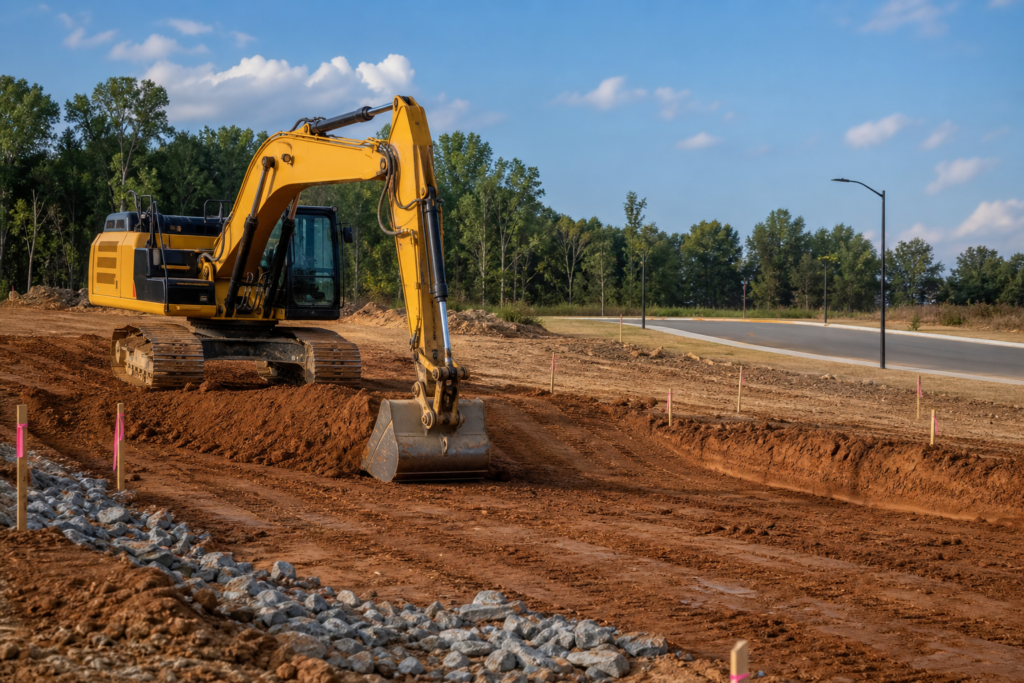
Reliable earthwork planning is more than calculating how much soil must be moved. For a construction project in Bethlehem, Georgia, the grading plan should connect current survey information, proposed elevations, drainage, erosion control, quantities, roadway transitions, and field verification. If one of those pieces is outdated or left undefined, the project may carry avoidable coordination problems into mobilization.
The checks below help developers, contractors, engineers, property owners, and public infrastructure teams decide whether a grading plan is ready for construction or needs updated calculations, field verification, stakeout support, or qualified surveying and engineering review.
Key Takeaways
- Ensure all survey data and existing elevations are current to avoid costly mistakes.
- Coordinate grading plans with stormwater drainage to prevent flooding and erosion issues.
- Document responsibilities for field verification and approvals to streamline the construction process.
- Review erosion and sediment controls in compliance with Georgia regulations to protect local ecosystems.
- Utilize a pre-mobilization checklist to confirm all aspects of the grading plan are ready for execution.
Quick summary

- Confirm that benchmarks, datum, control points, survey dates, and existing elevations are current and clearly identified.
- Compare proposed grades with drainage features, utilities, pavement limits, access points, and adjacent conditions.
- Review erosion and sediment controls before earthwork begins, and verify applicable Georgia requirements through official sources.
- Reconcile cut-and-fill quantities with hauling, unsuitable material, import, compaction, and trade-scope assumptions.
- Assign responsibility for field layout, verification, revisions, testing, approvals, and closeout documentation before crews mobilize.
1. Confirm current survey control and site inputs
Start by identifying the survey information behind the grading plan. The review should show the benchmarks, datum, control points, survey date, existing elevations, property or construction limits, and source documents used for the calculations. Without that information, a precise-looking grade or quantity may be based on conditions that no longer match the site.
Check whether excavation, prior grading, settlement, utility work, stockpiling, or other site changes could have altered existing conditions. Also confirm that plan revisions, alignments, and referenced elevations are consistent across the drawings. A focused earthwork grading calculations checklist can help organize this review before quantities or field work are approved.
If control, design intent, or required document seals are unclear, pause for qualified surveying or engineering review. A contractor or project manager should not treat an uncertain control point as construction authorization.
2. Compare existing and proposed elevations

Review the relationship between existing and proposed elevations rather than checking only a finished-grade number. Look at contours, slopes, retaining or transition areas, building pads, swales, pavement edges, utility locations, and connections to adjacent property. The important question is whether the proposed surface can be built and whether it connects logically to the features around it.
Separate the deliverable being reviewed. A preliminary estimate may support budgeting or early planning, while field layout, stakeout, or construction coordination requires more defined control and documentation. Construction stakeout guidance commonly distinguishes broad bulk-grading control from the tighter coordination needed for finish grading, pavement, curb lines, and utility inverts.
Ask the reviewer to identify steep transitions, abrupt grade changes, unresolved tie-ins, and areas where existing conditions differ from the plans. These items should become documented coordination questions, not silent assumptions inside a revised elevation.
3. Coordinate grading with stormwater drainage
Grading and stormwater drainage should be reviewed as one system. Confirm how surface slopes direct water toward or away from swales, pipes, drop inlets, catch basins, detention or underground storage features, outfalls, and overflow paths. Check that drainage structures are compatible with finished grades and that paving, utilities, curbs, and access routes do not interrupt the intended flow path.
Review the drainage design, construction documents, and responsible professional rather than inventing pipe capacities or assuming that a slope is adequate. The plan should identify the interfaces between earthwork, stormwater, erosion control, utilities, and pavement. It should also make clear which elevations must be verified before structures are installed or covered.
For Georgia construction sites, confirm whether an applicable NPDES construction stormwater permit and related requirements affect the project. The Georgia Environmental Protection Division identifies construction stormwater general permits GAR100001, GAR100002, and GAR100003 as authorizing qualifying stormwater discharges through July 31, 2028. See the official Georgia construction stormwater permit information for current details.
4. Plan erosion and sediment controls before earthwork
Erosion control should be sequenced with clearing, grading, drainage installation, stockpiling, and stabilization. Before soil is disturbed, identify the locations and maintenance responsibilities for measures such as silt fence, inlet protection, construction entrances, check dams, slope protection, seeding, mulching, or erosion matting when applicable to the approved plan.
Do not treat a generic checklist as a substitute for project-specific requirements. Georgia guidance calls for protections and best management practices that are consistent with applicable state requirements and the Georgia Manual for Erosion and Sediment Control. The Georgia Soil and Water Conservation Commission technical guidance is an appropriate starting point for verifying the governing framework.
Assign who will inspect controls, maintain them after rainfall or construction activity, document deficiencies, and authorize changes. Exposed slopes, drainage outlets, and inlets deserve particular attention because a grading plan can be geometrically correct while the active site remains vulnerable to sediment movement.
5. Reconcile earthwork quantities and scope assumptions
Before approving a takeoff, document what the quantities include and exclude. Review cut and fill areas, stripping or unsuitable material, excavation limits, surplus material, import needs, hauling assumptions, stockpiles, subgrade preparation, and interfaces with utilities, stormwater, concrete, asphalt, landscape, and erosion-control work.
Georgia DOT describes earthwork as including activities such as excavation, hauling, embankment construction, shoulders, subgrades, and handling undesirable or surplus material. Its earthwork training document provides useful terminology for checking whether the proposed scope reflects the actual work.
| Check | Risk it addresses | Documentation or input to confirm |
|---|---|---|
| Existing and proposed surfaces | Incorrect cut-and-fill quantities | Current survey, design surfaces, revision dates, and calculation basis |
| Unsuitable or surplus material | Unplanned hauling, disposal, or replacement work | Geotechnical direction when required, excavation assumptions, and disposal or import responsibility |
| Drainage and utility interfaces | Rework around structures, pipes, or inlets | Profiles, inverts, structure elevations, and coordinated drawings |
| Pavement and subgrade limits | Quantity gaps between earthwork and paving scopes | Subgrade elevations, pavement limits, and trade responsibility matrix |
Finally, identify whether the calculation is for preliminary budgeting, bid pricing, construction coordination, or payment measurement. Those purposes may require different levels of detail and review.
6. Check roadway, access, and pavement tie-ins
Driveways, access roads, turn lanes, pavement edges, curb lines, and adjacent grades can expose problems that are not visible in a broad grading plan. Review the proposed profile, horizontal alignment, stationing, tie-in elevations, drainage transitions, paving limits, and relationship to existing roads or entrances.
Where access or roadway work is involved, compare the roadway grade calculations with approved profiles, current field conditions, drainage requirements, and the intended construction phase. A change in an existing tie-in or pavement edge may affect earthwork, milling, asphalt thickness, erosion control, and traffic coordination at the same time.
For projects subject to Georgia DOT requirements, use the department’s current contractor reference material for applicable specifications, earthwork, erosion control, pavement, testing, and inspection topics. The official Georgia DOT contractor reference should be checked alongside the project documents rather than relying on an undated general assumption.
7. Define field verification and documentation responsibilities
Before mobilization, decide which information must be verified in the field and who is responsible for doing it. Depending on the project, the required support may include three-point level verification, construction stakeout plans, revised grade calculations, utility or drainage elevation checks, testing records, progress surveys, or as-built documentation.
Set the responsibility for establishing control, laying out work, checking elevations, approving deviations, recording revisions, and accepting completed grades. Field crews should know which document governs when a stake, drawing, calculation, and observed condition do not agree.
Also distinguish construction support from professional design responsibility. When the work affects agency requirements, sealed documents, survey control, or engineering judgment, identify the qualified professional or approving authority before construction relies on the result. Clear responsibility is as important as the calculation itself.
Pre-mobilization checklist for Bethlehem earthwork
Use this final readiness check before equipment and crews begin work:
- Current plans, revisions, specifications, survey files, benchmarks, datum, and control points are identified.
- Existing and proposed elevations, contours, slopes, pads, transitions, and tie-ins have been reviewed together.
- Drainage structures, pipes, swales, outfalls, overflow paths, utilities, and finished grades are coordinated.
- Erosion and sediment controls, sequencing, inspection, maintenance, and stabilization responsibilities are defined.
- Cut-and-fill quantities identify assumptions for stripping, unsuitable material, hauling, import, surplus, and subgrade work.
- Roadway, driveway, pavement, curb, and access connections have a documented grade and alignment review.
- Field verification, stakeout, testing, revisions, approvals, and closeout records have assigned owners.
- Applicable Georgia stormwater, erosion-control, owner, municipal, or transportation requirements have been verified from current sources.
Frequently asked questions
What survey information should be current before earthwork begins in Bethlehem?
At minimum, identify the survey date, benchmarks, datum, control points, existing elevations, property or work limits, and source documents used for the grading calculations. Confirm whether excavation, settlement, utility work, or other site activity may have changed conditions. If control or design intent is uncertain, obtain qualified surveying or engineering review before relying on the information.
How should grading plans be coordinated with stormwater drainage and erosion control?
Review surface slopes, drainage structures, pipes, inlets, outfalls, overflow paths, and erosion-control measures as a connected sequence. Confirm that controls are installed before or alongside soil disturbance and that inspection and maintenance duties are assigned. Applicable Georgia requirements and project permits should be verified through the relevant official sources.
When does a project need construction stakeout or roadway grade calculation support?
Consider that support when grading, pavement, curb, utilities, roadway profiles, turn lanes, access points, or drainage structures depend on repeatable field elevations and alignment. It is particularly useful when a preliminary estimate must become construction coordination information, or when existing field conditions differ from the approved documents.
What should be documented before approving earthwork quantities and mobilizing crews?
Document the calculation basis, current surfaces, cut-and-fill limits, unsuitable and surplus material assumptions, hauling or import responsibility, drainage and utility interfaces, pavement limits, erosion-control sequence, required field checks, and responsible reviewers. Also state whether the quantities are for budgeting, bidding, construction coordination, or payment measurement.
Conclusion: Treat grading as a coordinated construction decision
The strongest earthwork plans do not isolate dirt quantities from the rest of the site. They connect survey control and elevations with drainage, erosion control, utilities, roadway and pavement tie-ins, scope assumptions, and field documentation. Reviewing those seven areas before mobilization gives the project team a clearer basis for deciding whether the plans are ready or need additional support.
For Georgia projects requiring earthwork and grading, stormwater or erosion-control coordination, roadway calculations, stakeout planning, or estimating and takeoff support, discuss the project documents and requested scope with DCBC LLC.