
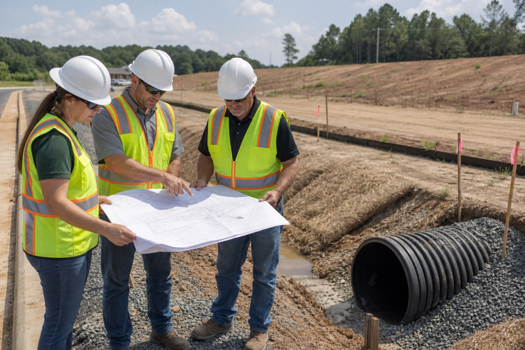
Stormwater drainage design in Bethlehem should be treated as part of the entire civil site work plan, not as an isolated decision about pipes or inlets. Grading, roadway access, pavement, erosion control, adjacent properties, construction sequencing, and agency requirements can all affect runoff management.
The best first step is to assemble reliable site information, identify every drainage interface, and clarify who is responsible for design, approval, field layout, installation, inspections, and as-built documentation. Contractors can provide valuable constructability and quantity input, but project-specific engineering and agency approvals remain with the appropriate professionals and authorities.
Key Takeaways
- Assemble comprehensive site information, including surveys and existing drainage conditions, before pricing.
- Coordinate grading and roadway access to ensure effective runoff management.
- Define responsibilities for design, construction, and documentation to avoid disputes.
- Utilize Georgia DOT resources for stormwater design best practices.
- Clearly outline the scope of work when requesting quotes to facilitate accurate proposals.
Quick summary

- Gather surveys, elevations, existing drainage information, property limits, utilities, access plans, and site constraints before requesting pricing.
- Review drainage with grading, turn lanes, driveways, pavement transitions, slopes, ditches, and downstream conditions.
- Coordinate erosion and sediment control with clearing, grading, pipe installation, inlet work, stockpiles, and stabilization.
- Put design, construction, inspection, layout, maintenance, and closeout responsibilities in writing.
- Tell bidders whether you need turnkey civil site work, construction support, or specialized takeoff, stakeout, or as-built services.
1. Start with the site information that drives drainage decisions
Drainage planning depends on what water is doing on and around the property. Before design or pricing, assemble available boundary and topographic surveys, elevations, property limits, existing pavement, slopes, ditches, culverts, utilities, structures, drainage features, and downstream conditions.
Identify the project type and access objective as well. A commercial development, residential subdivision, roadway improvement, and public infrastructure project may have different grading, traffic, documentation, and review needs. Include adjacent properties and existing driveways because changes at one access point can alter runoff paths or create conflicts at the property edge.
For broader context, review how civil site work in Bethlehem connects drainage with grading, erosion control, utilities, and site preparation. This wider view helps prevent drainage from being priced without the earthwork and stabilization work it depends on.
2. Coordinate grading, roadway access, and runoff

A new driveway, turn lane, acceleration lane, deceleration lane, roadway crossing, or pavement widening can change the relationship between the site and the existing roadway. Review finished grades, ditches, slopes, inlets, pipes, culverts, pavement transitions, downstream conditions, and neighboring properties together.
Turn lane planning in Bethlehem should account for grades, drainage structures, erosion-control measures, and connections with existing conditions. A contractor can identify installation constraints, sequencing concerns, quantities, and constructability questions, while the design team handles applicable design decisions and approvals.
Do not assume that drainage structures can be added after grading or paving. Confirm which structures must be installed before subgrade preparation, what elevations control the work, and how drainage interfaces with pavement, curbs, shoulders, slopes, and temporary access.
3. Match drainage components to the approved design
Common stormwater components include HDPE pipe, reinforced concrete pipe, ductile iron pipe, drop inlets, catch basins, flumes, spillways, manholes, slope drains, roadway crossings, and underground ponds. These components are not interchangeable simply because they perform related functions. Selection, sizing, placement, connections, elevations, and materials depend on project-specific engineering and approved plans.
Ask the project team to identify each component’s intended function and interfaces. Important questions include: What receives runoff? Where does it discharge? Which structures require maintenance access? How will pipes cross the roadway or connect to existing systems? What happens if field conditions differ from the plans?
Georgia DOT’s Stormwater Design Guide addresses stormwater analysis, water-quality considerations, detention analysis, and best-management practices. Use applicable design documents and the project-specific review process rather than treating a component list as a final drainage design.
4. Plan erosion and sediment control alongside drainage
Erosion control should begin with clearing and grading, not at the end of the project. Disturbed slopes, stockpiles, drainage paths, inlets, pipe trenches, and roadway edges may require protection while permanent work is underway.
Depending on the approved plans and site conditions, measures may include silt fence, inlet protection, seeding and mulching, check dams, and erosion matting. Confirm not only what will be installed, but also who will maintain, monitor, repair, and adjust each measure as conditions change.
Georgia EPD identifies the Georgia Stormwater Management Manual as a primary statewide technical reference for stormwater management design and runoff control. Its construction stormwater instructions also address permit-related GEOS submittals. Requirements vary by project, so confirm applicable obligations with the design team and reviewing authorities.
5. Clarify who designs, approves, builds, and documents the work
Many drainage disputes result from unclear handoffs rather than unavailable equipment. Use this comparison to separate professional design and approval from contractor support and construction execution.
| Responsibility | Typical decisions or deliverables | Questions to confirm |
|---|---|---|
| Design professional | Drainage analysis, layout, grades, sizing, details, and revisions | Who seals the plans and approves field changes? |
| Reviewing agency | Applicable standards, plan review, comments, and approvals | Which requirements apply, and who tracks submissions? |
| Contractor | Constructability, quantities, sequencing, installation, grading, and erosion control | What is included, excluded, or subject to written direction? |
| Survey or layout support | Stakeout, elevation checks, reference points, and field verification | Who provides layout and verifies grades? |
| Closeout team | Installed-location records, revisions, inspection information, and as-builts | What format is required, and who reviews it? |
DCBC LLC describes support for construction stakeout plans, roadway grade calculations, estimation and takeoff, and GDOT as-built GIS submittals. These services can help define field and documentation needs, but they do not replace project-specific engineering or agency approval.
6. Define construction and closeout scope before pricing
A drainage quote should identify more than a general “stormwater” allowance. State the limits of clearing, grading, trenching, pipe installation, structures, connections, roadway crossings, backfill, surface restoration, and erosion-control work. Identify whether temporary measures and maintenance are included.
Define interfaces with paving and access improvements. Confirm who prepares subgrade, adjusts structures, coordinates elevations, installs pavement around inlets or manholes, completes striping and signage, and handles corrections when field conditions differ from plans.
Specify closeout requirements such as installed-location records, grade verification, inspection information, quantity reconciliation, revisions, or a GDOT as-built GIS submittal. A clear closeout scope makes proposals easier to compare.
7. Prepare a complete Bethlehem-area quote request
Give prospective contractors enough information to understand both the physical work and the support required. Include:
- Project location and development type.
- The purpose of the access or drainage improvement.
- Available boundary, topographic, civil, roadway, and drainage plans.
- Existing pavement, slopes, ditches, structures, utilities, and known constraints.
- Expected vehicle movements, delivery activity, construction access, and emergency-access needs.
- Known engineer, surveyor, owner, municipality, or Georgia DOT involvement.
- Requested grading, drainage, pipe, structure, paving, milling, erosion-control, striping, signage, or staging scope.
- Requested stakeout, grade calculation, estimation, takeoff, or as-built deliverables.
- Schedule constraints, phasing assumptions, and access requirements.
State whether you need turnkey work or a specialized scope. One request may cover grading, stormwater systems, erosion control, paving, and closeout. Another may require only layout, quantity takeoff, roadway grade verification, or documentation support.
8. Choose the support model that fits the project
A design-led project may bring in a contractor after plans are developed for constructability review, quantities, sequencing, and installation. This suits teams that already have a design professional and need a clear construction package.
A turnkey civil site work model combines several field scopes under one construction partner. It may fit a development or infrastructure project requiring coordinated grading, stormwater work, erosion control, paving, striping, signage, and project management. The proposal should still define exclusions, design responsibilities, agency handoffs, and closeout requirements.
A specialized consulting or documentation model may fit projects needing stakeout plans, roadway grade calculations, three-point level verification, estimation and takeoff, or GDOT as-built GIS support. DCBC LLC lists these capabilities alongside stormwater systems, earthwork and grading, erosion control, asphalt paving and milling, and roadway work. Match the service to the project stage instead of requesting a broader scope than necessary.
Stormwater drainage design in Bethlehem FAQ
What information should I provide when requesting stormwater drainage support?
Provide the project location, development type, access objective, available surveys and plans, topography, existing drainage, utilities, slopes, pavement, expected vehicle movements, agency involvement, requested scope, and closeout deliverables. Identify unavailable information so proposal assumptions are clear.
Can a site work contractor review drainage constructability?
Yes. A contractor can review access, grading, pipe and structure installation, sequencing, quantities, pavement interfaces, erosion-control measures, and field constraints. This supports constructability and pricing but does not replace engineering, design certification, or agency approval.
Does roadway access improvement affect drainage planning?
It can. A turn lane, driveway, roadway crossing, or pavement widening may change grades, ditches, slopes, inlets, pipes, culverts, discharge paths, and adjacent-property conditions. Review access and drainage together before assigning construction responsibilities.
Who is responsible for stormwater approval and construction documentation?
The responsible design professional and reviewing agency determine the design and approval path. The contract should state who collects field information, records revisions, prepares installed-location information, and submits required final deliverables.
Conclusion: Coordinate the drainage scope before mobilization
Effective stormwater drainage planning begins with reliable site information and a coordinated view of grading, roadway access, pavement, erosion control, drainage structures, and downstream conditions. Before requesting a quote, assign responsibilities among the design team, reviewing agency, contractor, survey or layout provider, and closeout team.
For Bethlehem-area commercial, residential subdivision, roadway, and public infrastructure work, DCBC LLC offers civil site work and roadway construction support, including stormwater systems, grading, erosion control, asphalt paving and milling, construction stakeout plans, roadway grade calculations, estimation and takeoff, and GDOT as-built GIS submittals.