
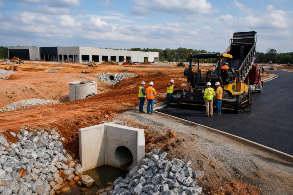
Effective civil site work in Bethlehem depends on coordination, not isolated trade packages. Grading affects drainage, drainage affects pavement and building areas, and utility or erosion-control decisions can affect access, inspections, and closeout. Before mobilization, the project team should align the plans, field conditions, permits, responsibilities, and records that connect these activities.
The following checklist is designed for developers, general contractors, property managers, public agencies, and engineering teams planning commercial, residential subdivision, roadway, or public infrastructure work. For local context, site work planning tips should account for surveys, soils information, permitting coordination, drainage, utilities, sequencing, erosion control, compaction, and closeout documentation.
1. Align the Scope and Responsibility Boundaries
Start by identifying which drawings and specifications control the work, including their revision dates. Then list inclusions, exclusions, alternates, interfaces, inspection hold points, and required deliverables. A proposal should make clear who handles grading, drainage structures, utilities, asphalt, striping, signs, erosion controls, testing, traffic control, and final records.
This matters because a gap between packages can become a field conflict. For example, a grading change may affect a drainage inlet, accessible route, pavement elevation, or material quantity. A civil site work checklist can help organize permits, surveys, utility information, grade controls, inspections, and closeout responsibilities before the contractor mobilizes.
2. Confirm Surveys, Soils, and Existing Conditions

Review the boundary and topographic survey, geotechnical information, existing utility records, benchmarks, and available drainage or as-built information. Confirm which survey data is current and who is responsible for establishing or verifying construction control. If the site has changed since design, document the difference before making a decision based on older information.
Soils and subsurface conditions can influence grading, fill, compaction, pavement preparation, and drainage work. Identify testing requirements, unsuitable material procedures, groundwater concerns, and the process for resolving conditions that differ from the plans. Existing information should support the work, but field verification remains important before construction decisions are made.
3. Map Permits and Georgia Compliance Requirements
Before land disturbance, identify the permits, agency reviews, right-of-way requirements, utility approvals, and inspection steps that apply to the specific project. Do not assume that a checklist for one Bethlehem or Barrow County site applies unchanged to another. Identify the responsible owner, designer, contractor, and approving authority for each requirement.
Georgia’s Environmental Protection Division provides erosion and sedimentation procedures, best-management-practice guidance, and construction stormwater permit resources. Its current NPDES construction stormwater general permits authorize qualifying construction-site discharges through July 31, 2028. Confirm current applicability and project-specific obligations through the appropriate authority and approved plans. See the Georgia EPD erosion and sedimentation resources and NPDES construction stormwater information.
Projects involving state routes or Georgia DOT work should identify applicable specifications, inspection, sampling, testing, and erosion-control requirements. Georgia DOT’s contractor reference materials, known as The Source, cover these subjects. Certification or contractor experience does not replace project-specific approvals or agency review.
4. Establish Grade Control and Field Layout
Grade control should connect the approved design to field work. Identify building areas, grading points, roadway grades, drainage features, paving limits, turn lanes, and other elements that must be located or verified. Define control information, tolerances, checking procedures, responsible parties, and the process for handling revised plans.
Construction stakeout plans can support this coordination, but they do not replace a boundary or topographic survey, engineering design, professional review, or agency approval. The required scope varies by project and may include house locations, roadway grades, grading points, drainage features, or paving limits. Review the expected construction stakeout plans and clarify whether the deliverable is a plan, calculation, field layout, verification service, or combination.
5. Coordinate Stormwater and Drainage With Site Grades
Review stormwater alongside slopes, building pads, parking areas, roadways, crossings, outfalls, and downstream connections. The team should know where water is expected to flow, where it will be collected, how structures connect, and who will verify field conditions before installation. Pipe and structure selections should follow the approved design and applicable criteria rather than a generic preference.
Define responsibilities for stormwater systems, crossings, drop inlets, catch basins, manholes, slope drains, flumes, spillways, ponds, inspections, and changes. Georgia rules address land-disturbance permit applications and controls where stream piping could increase downstream flow velocity. The responsible design professional and approving authority should determine the project-specific solution.
6. Install and Maintain Erosion and Sediment Controls
Erosion control is not a one-time installation before grading. Plan the construction entrance, silt fence, inlet protection, check dams, erosion matting, seeding, mulching, stabilization, inspection, maintenance, and removal or transition of controls as the site changes. Controls should match approved plans, terrain, drainage paths, construction sequence, and current site conditions.
Assign who inspects each measure, records findings, corrects deficiencies, and responds when weather or construction changes require additional action. Do not treat a control shown on a drawing as effective without checking whether it remains installed, functional, and properly maintained. Review Georgia’s erosion and sedimentation rules alongside applicable project requirements.
7. Coordinate Utilities, Structures, and Site Interfaces
Before grading and paving, map existing utilities and proposed routes, crossings, clearances, depths, access points, drainage structures, building areas, and roadway connections. Confirm who will locate utilities, verify conflicts, approve changes, and communicate revised information to affected trades.
Interface planning is especially important where utility work crosses a road, parking area, drainage system, or building access route. A conflict discovered after subgrade preparation or paving can require disruptive rework. Include utility records, field verification, structure elevations, access requirements, and conflict-resolution procedures in the pre-mobilization review.
8. Sequence Earthwork, Paving, Striping, and Traffic Elements
Establish the relationship between clearing, mass grading, utility installation, drainage, subgrade preparation, asphalt milling or paving, parking areas, turn lanes, striping, signs, and wheel stops. Identify when access is needed, which inspections or tests must occur before the next activity, and how unfinished areas will be protected from weather and traffic.
Do not schedule paint striping, signs, or wheel stops without confirming that pavement limits, grades, access, and surface conditions are ready. Asphalt is not an isolated finish layer. Its performance depends on prepared subgrade, drainage, grades, and the approved pavement design.
9. Track Quantities, Testing, and Field Changes
Set up a record for estimated quantities, delivered materials, installed quantities, tests, inspections, daily progress, approved changes, and outstanding decisions. Estimation and takeoff should remain connected to current drawings and site conditions rather than being treated as a one-time number that stays accurate after design or field changes.
Define who checks grades, records material quantities, maintains daily logs, requests testing, documents changed work, and updates drawings or records. Contractor documentation supports project control, but it does not replace required surveying, engineering verification, qualified testing, or agency review.
10. Define Closeout Records Before Work Starts
Identify closeout requirements during planning, not after the final inspection. List expected punch-list responses, inspection logs, test results, final stabilization records, pavement markings, utility and drainage records, record drawings, and applicable municipal or GDOT as-built GIS deliverables.
GIS documentation can organize location-based records, field changes, infrastructure features, and completed work. It does not replace surveying, engineering design, construction staking, or an agency’s acceptance decision. For projects that depend on location-based records, GIS mapping for civil projects should have a clear purpose, source information, verification process, format, and responsible reviewer.
Choose the Right Support Model for the Project
The best delivery model depends on project size, technical interfaces, internal staff, documentation burden, and the need for field execution. The following comparison is a planning aid, not a ranking of providers.
| Support model | May fit when | Questions to resolve |
|---|---|---|
| In-house management | The owner or general contractor can coordinate trades, permits, inspections, quantities, and closeout. | Who owns field verification, technical deliverables, daily records, and unresolved design questions? |
| Contractor-led delivery | The project benefits from one construction partner coordinating a defined turnkey or specialized civil scope. | Which work is included, which trades are excluded, and what remains with the owner, engineer, surveyor, or agency? |
| Hybrid field and virtual support | The team needs construction execution plus plans, calculations, takeoffs, GIS records, or related consulting deliverables. | How will office-based deliverables connect to current surveys, field conditions, approved revisions, and construction decisions? |
DCBC LLC describes a combined construction and consulting model for Georgia projects, with listed capabilities including civil site work, asphalt paving and milling, earthwork and grading, stormwater systems, erosion control, construction stakeout plans, roadway grade calculations, three-point level verification, GDOT as-built GIS submittals, and estimation and takeoff. Confirm the exact scope, deliverables, and professional responsibility boundaries in the proposal.
Pre-Mobilization Questions to Ask Every Site Work Contractor
- Which drawing set and revision control the work?
- What is included, excluded, optional, or assigned to another trade?
- Who is responsible for surveys, benchmarks, grade control, stakeout, and field verification?
- Which permits, right-of-way approvals, inspections, and agency submissions apply?
- How will stormwater, erosion controls, utilities, paving, and traffic elements be sequenced?
- What testing, inspection, hold-point, and daily reporting procedures are included?
- How are changed conditions, plan revisions, quantity changes, and disputed responsibility handled?
- Which closeout documents, record drawings, GIS files, test results, and stabilization records will be delivered?
- What remains with the licensed surveyor, engineer, owner, or approving authority?
A Final Decision Checklist for Bethlehem Projects
Before approving mobilization, confirm that the team has a current plan set, verified existing conditions, suitable survey and soils information, a permit and agency matrix, assigned responsibility boundaries, a grade-control method, coordinated drainage and erosion controls, a utility conflict process, a paving and traffic sequence, quantity and testing records, and agreed closeout deliverables.
If any answer is unclear, resolve that gap before the affected work begins. The contract should state exactly what is being delivered and what remains with the surveyor, engineer, owner, or agency.
Frequently Asked Questions
What should be confirmed before starting civil site work in Bethlehem?
Confirm the controlling plans, surveys, soils information, existing utilities, permits, drainage approach, erosion-control measures, grade-control process, trade interfaces, inspection points, testing, quantities, and closeout records. Exact requirements depend on the project and approving authorities.
Do construction stakeout plans replace a survey or engineering design?
No. Stakeout plans help organize or communicate approved design information for field layout or verification. They do not replace surveying, engineering design, professional certification, field-condition verification, or agency approval.
How should a Bethlehem project coordinate stormwater and erosion control?
Review drainage paths, collection points, structures, crossings, outfalls, slopes, and stabilization measures together. Match controls to approved plans and current site conditions, then assign inspection and maintenance responsibilities.
When does a hybrid civil construction and consulting model make sense?
A hybrid model may fit when a project needs both field construction and defined virtual deliverables such as stakeout plans, grade calculations, three-point level verification, estimation and takeoff, or GIS-related documentation.
What closeout documents should a site work contractor provide?
Depending on the contract, closeout may include punch-list responses, inspection logs, testing records, stabilization documentation, pavement and traffic-element records, utility and drainage information, record drawings, and applicable municipal or GDOT as-built GIS submissions.
Conclusion: Coordinate the Site Before Mobilizing
The strongest civil site work plans treat grading, drainage, erosion control, utilities, pavement, traffic elements, quantities, and closeout as connected decisions. For a Bethlehem project, the practical test is whether the team can show current information, clear responsibility boundaries, coordinated sequencing, defined verification, and records that match required approvals.
DCBC LLC provides civil site work and roadway construction, along with virtual and consulting support for Georgia commercial, residential subdivision, roadway, and public infrastructure projects. To discuss a construction or consulting scope, contact DCBC LLC for a project quote.